We have completed Historic Landscape Characterisation (HLC) mapping for the Oxford local authority area. The HLC approach involves the use of digital maps to record changes in landscape character since the development of more accurate scaled maps in the later 19th century.
Historic Landscape Characterisation typically considers aspects of built environment and the natural and as shaped by human activity, for example types and forms of enclosed fields or changing patterns of industrial or residential development.
The completion of Historic Landscape Characterisation for Oxford compliments the programme of HLC mapping currently being undertaken for the remainder of the county.
For more information on the role of HLC please visit Historic England's Understanding Historic Places pages.
To obtain Oxford HLC data please contact us.
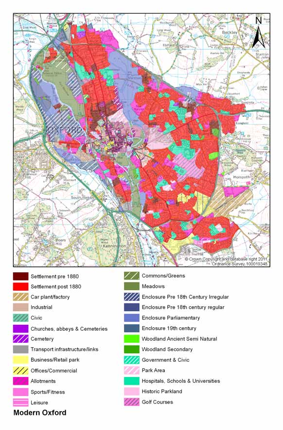
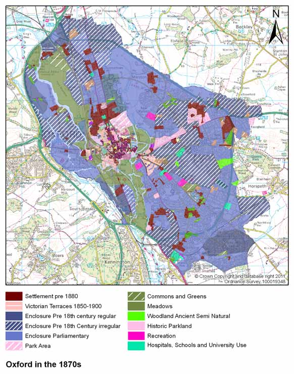
Summary maps of Oxford's HLC study are provided below.
Map showing landscape character in 1870s Oxford
Map showing landscape character in modern-day Oxford