- Conservation Area
- North Oxford Victorian Suburb
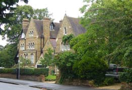
- Photograph
-
- Background
-
The extension and enlargement of the North Oxford conservation area, with the inclusion of the Rawlinson Road conservation area on 16 July 1976, resulted in the creation of the consolidated North Oxford Victorian Suburb conservation area. It stretches from St Giles' in the south, to Frenchay, Staverton and Belbroughton Roads in the north; from the banks of the Oxford canal in the west, to those of the River Cherwell in the east, encompassing the "essential North Oxford".
Much of the area on which North Oxford now stands, formerly Walton Field and St Giles' Field, was acquired by St John's College in the 16th century. It was developed between Walton Manor and Summertown as a residential suburb of large detached and semidetached houses beginning in the 1850s with the laying out of Park Town (1853-5). - Date of Designation
- 6 May 1968
- Date extended
-
21 December 1972
15 April 1975
16 July 1976 - Further Information
-
Traditional iron railings were once an important and distinctive feature of the North Oxford Victorian Garden Suburb.
Many of the railings were removed during the war and of those surviving many are in need of repair or replacement. Increasingly many building owners wish to reinstate their boundary ironwork to enhance the appearance of their property, but are unsure where to start.
A guide has been prepared by Oxford Preservation Trust and Oxford City Council and is intended to assist residents in the reinstatement of their railings. - Available Documents
North Oxford Victorian Suburb - Conservation Areas
Was this webpage helpful?


